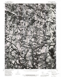
1979 Map of Maryknoll
USGS Topo · Published 1980About this map
The Cuivre River carves a winding path across this orthophotoquad, defining the agricultural landscape of Lincoln County in late 1979. This hybrid survey, produced in cooperation with the Soil Conservation Service, uses high-altitude aerial imagery to reveal the intricate patterns of timbered draws and cultivated fields. The settlement of Old Monroe sits near the eastern edge, while the town of Chain of Rocks is situated along the river's bend, showcasing the relationship between early Missouri towns and local waterways. Further west, the map captures the rural clusters of Ethlyn and Maryknoll. The inclusion of Big Creek provides further detail on the area's drainage and topography, making it a valuable resource for understanding land use and property lines in this riverine corridor during the late twentieth century.
Find a feature on this map
6 named features on this map. Tap any name to fly to it.
Don’t see what you’re looking for? This feature index may not catch every label — zoom into the map to look around manually.
Map Details
Editions of this 1979 Maryknoll Map
This is the sole edition of this map. No revisions or reprints were ever made.
Other maps of this area

1903 · O'Fallon
USGS Topo · 1:125,000

1930 · Hardin
USGS Topo · 1:62,500

1931 · Brussels
USGS Topo · 1:62,500

1934 · Elsberry
USGS Topo · 1:48,000

1934 · Hardin
USGS Topo · 1:62,500

1938 · Hardin
USGS Topo · 1:62,500

1939 · Brussels
USGS Topo · 1:62,500

1941 · Troy
USGS Topo · 1:62,500

1942 · Elsberry
USGS Topo · 1:62,500

1943 · Brussels
USGS Topo · 1:62,500