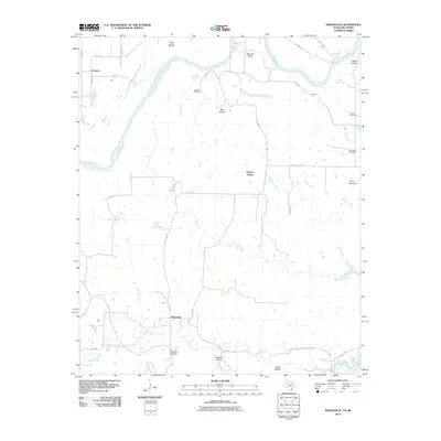
2010 Map of Marysville
USGS Topo · Published 2010About this map
Marysville and Jimtown anchor this northern Cooke County landscape along the winding course of the Red River, which defines the border between Texas and Oklahoma. The map documents a predominantly rural environment carved by numerous drainages, including North Fish Creek, South Fish Creek, and Bear Head Creek. The terrain is characterized by distinctive local landmarks like Nubbin Ridge and Three Mounds, while several named depressions such as Birchum Hollow and Blue Hollow suggest a complex topography of ridges and draws leading toward the river valley.
Find a feature on this map
43 named features on this map. Tap any name to fly to it.
Don’t see what you’re looking for? This feature index may not catch every label — zoom into the map to look around manually.
Map Details
Editions of this 2010 Marysville Map
This is the sole edition of this map. No revisions or reprints were ever made.
Other maps of this area

1902 · Gainesville
USGS Topo · 1:125,000

1943 · Gainesville
USGS Topo · 1:125,000

1954 · Sherman
USGS Topo · 1:250,000

1958 · Sherman
USGS Topo · 1:250,000

1960 · Gainesville North
USGS Topo · 1:24,000

1961 · Muenster West
USGS Topo · 1:24,000

1961 · Muenster East
USGS Topo · 1:24,000
1968 · Thackerville
USGS Topo · 1:24,000
1968 · Burneyville
USGS Topo · 1:24,000
1968 · Leon North
USGS Topo · 1:24,000