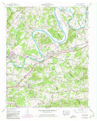
1966 Map of Mascot
USGS Topo · Published 1980About this map
Mascot and Strawberry Plains anchor this late 1960s study of the Holston River valley, where the landscape is defined by the winding river and a network of historic settlements across the Knox, Grainger, and Jefferson county lines. The Southern Railway and the Andrew Johnson Highway parallel the river through a region dense with family-named cemeteries such as McBee Cem and Clift Cem. Cultural centers of the era include Carter High School and the Rush Strong School, alongside several rural churches like Lyon Creek Church and Pleasant Grove (Piney) Church. The topography is marked by distinctive water features including Byerley Bend and McKinney Islands, showing a rural landscape in transition as it balances agricultural roots with the development of places like Trentville and the industrial presence at the House Mountain Substation.
Find a feature on this map
95 named features on this map. Tap any name to fly to it.
Don’t see what you’re looking for? This feature index may not catch every label — zoom into the map to look around manually.
Map Details
Editions of this 1966 Mascot Map
4 editions found
Other maps of this area

1886 · Knoxville
USGS Topo · 1:125,000

1892 · Knoxville
USGS Topo · 1:125,000

1894 · Knoxville
USGS Topo · 1:125,000

1895 · Knoxville
USGS Topo · 1:125,000

1897 · Maynardville
USGS Topo · 1:125,000

1900 · Maynardville
USGS Topo · 1:125,000

1901 · Knoxville
USGS Topo · 1:125,000

1935 · Luttrell
USGS Topo · 1:24,000

1935 · Mascot
USGS Topo · 1:24,000

1935 · Knoxville
USGS Topo · 1:48,000