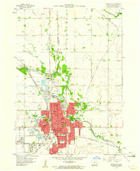
1959 Map of Mason City
USGS Topo · Published 1960About this map
Mason City serves as the industrial and transit hub of Cerro Gordo County in the late 1950s, defined by a dense network of five major railroads including the Chicago Rock Island and Pacific and the Mason City and Clear Lake. The city's growth is reflected in its numerous neighborhood institutions, from Elmwood Cemetery and St Josephs Cem to a local educational system featuring McKinley, Harding, and Lincoln schools.
Find a feature on this map
61 named features on this map. Tap any name to fly to it.
Don’t see what you’re looking for? This feature index may not catch every label — zoom into the map to look around manually.
Map Details
Editions of this 1959 Mason City Map
2 editions found
Other maps of this area

1954 · Mason City
USGS Topo · 1:250,000

1957 · Mason City
USGS Topo · 1:250,000

1958 · Mason City
USGS Topo · 1:250,000

1959 · Mason City
USGS Topo · 1:24,000

1959 · Mason City
USGS Topo · 1:62,500

1959 · Nora Springs
USGS Topo · 1:24,000

1959 · Mason City SE
USGS Topo · 1:24,000

1959 · Hanford
USGS Topo · 1:24,000

1972 · Manly
USGS Topo · 1:24,000

1972 · Burchinal
USGS Topo · 1:24,000