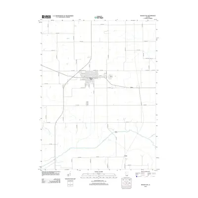
2012 Map of Mason City
USGS Topo · Published 2012About this map
Mason City stands as the primary hub of this Central Illinois landscape, organized by a rigid grid of county roads and a dense street network that includes W Arch St and E Roosevelt Rd. The town is the site of several local landmarks, including the Po and the Mason City Cem on its eastern edge. Outside the main settlement, the land is defined by its drainage systems, featuring the aptly named Sleepy Hollow Ditch and several winding waterways such as Salt Cr and Sugar Cr. The small community of Luther sits to the east, connected by a network of rural routes. In the south, Hubly Bridge crosses the creek, marking a specific point of passage in a region primarily dedicated to agriculture. The map reflects a modern era of transportation while preserving the paths of historical thoroughfares like Old Route 29.
Find a feature on this map
59 named features on this map. Tap any name to fly to it.
Don’t see what you’re looking for? This feature index may not catch every label — zoom into the map to look around manually.
Map Details
Editions of this 2012 Mason City Map
This is the sole edition of this map. No revisions or reprints were ever made.
Other maps of this area

1929 · Manito
USGS Topo · 1:62,500

1932 · Manito
USGS Topo · 1:62,500

1933 · Petersburg
USGS Topo · 1:62,500

1938 · Petersburg
USGS Topo · 1:62,500

1942 · Delavan
USGS Topo · 1:62,500

1948 · Mason City
USGS Topo · 1:62,500

1949 · Mason City
USGS Topo · 1:62,500

1958 · Peoria
USGS Topo · 1:250,000

1961 · Peoria
USGS Topo · 1:250,000

1963 · Peoria
USGS Topo · 1:250,000