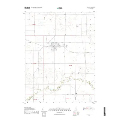
2018 Map of Mason City
USGS Topo · Published 2018About this map
Mason City sits at the heart of this central Illinois landscape, its grid of residential streets including E Myrtle St, E Walnut St, and E Chestnut St defined by the surrounding agricultural expanse. The area's genealogical history is marked by several burial grounds, including the Mason City Cem just east of town, Cherry Grove Cem to the north, and Swing Grove Cem further south. The southern portion of the map is dominated by the winding course of Salt Creek, which forms the boundary between Mason Co and Menard Co. This riparian corridor is joined by tributaries like Sleepy Hollow Ditch and Sugar Creek, with the Hubly Bridge providing a key crossing point near the small settlement of Hubly. Local landmarks like Ellsberry Lake and the former stop at Luther reflect the long-standing rural community structure of the region.
Find a feature on this map
38 named features on this map. Tap any name to fly to it.
Don’t see what you’re looking for? This feature index may not catch every label — zoom into the map to look around manually.
Map Details
Editions of this 2018 Mason City Map
This is the sole edition of this map. No revisions or reprints were ever made.
Other maps of this area

1929 · Manito
USGS Topo · 1:62,500

1932 · Manito
USGS Topo · 1:62,500

1933 · Petersburg
USGS Topo · 1:62,500

1938 · Petersburg
USGS Topo · 1:62,500

1942 · Delavan
USGS Topo · 1:62,500

1948 · Mason City
USGS Topo · 1:62,500

1949 · Mason City
USGS Topo · 1:62,500

1958 · Peoria
USGS Topo · 1:250,000

1961 · Peoria
USGS Topo · 1:250,000

1963 · Peoria
USGS Topo · 1:250,000