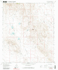
1964 Map of Massacre Peak
USGS Topo · Published 1984About this map
Massacre Peak dominates the center of this landscape, marking a terrain defined by high ridges and historical frontier infrastructure. The eastern slopes hold the site of Fort Cummings and the nearby Fort Cummings Cem, positioned where the Butterfield Trail passes through the region. This portion of the Cookes Range shows a complex system of water management, evidenced by five separate detention dams along Starvation Draw, which likely served to mitigate flash flooding in the arid climate.
Find a feature on this map
35 named features on this map. Tap any name to fly to it.
Don’t see what you’re looking for? This feature index may not catch every label — zoom into the map to look around manually.
Map Details
Editions of this 1964 Massacre Peak Map
2 editions found
Other maps of this area

1899 · Deming
USGS Topo · 1:125,000

1915 · Deming
USGS Topo · 1:125,000

1955 · Las Cruces
USGS Topo · 1:250,000

1956 · Dwyer
USGS Topo · 1:62,500

1958 · Las Cruces
USGS Topo · 1:250,000

1962 · Lake Valley
USGS Topo · 1:62,500

1964 · Goat Ridge
USGS Topo · 1:24,000

1964 · Florida
USGS Topo · 1:24,000

1964 · Deming West
USGS Topo · 1:24,000

1964 · Massacre Peak
USGS Topo · 1:24,000