
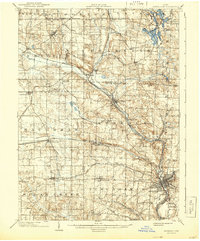
1903 Map of Massillon
USGS Topo · Published 1934About this map
The Tuscarawas River valley in the early twentieth century serves as a busy corridor of industry and transport, defined by the winding Ohio Canal and a dense network of competing railroads. Industrial activity is prominent north of Massillon, where the Turkeyfoot Mine and Eureka Mine indicate the region's extraction economy. Further south, the map identifies the Insane Asylum on the outskirts of the city, reflecting the social infrastructure of the era.
Find a feature on this map
71 named features on this map. Tap any name to fly to it.
Don’t see what you’re looking for? This feature index may not catch every label — zoom into the map to look around manually.
Map Details
Editions of this 1903 Massillon Map
2 editions found
Other maps of this area

1901 · Massillon
USGS Topo · 1:62,500

1901 · Canton
USGS Topo · 1:62,500

1901 · Wooster
USGS Topo · 1:62,500

1903 · Wooster
USGS Topo · 1:62,500

1903 · Canton
USGS Topo · 1:62,500

1903 · Akron
USGS Topo · 1:62,500

1904 · Medina
USGS Topo · 1:62,500

1905 · Akron
USGS Topo · 1:62,500

1906 · Medina
USGS Topo · 1:62,500

1906 · Kent
USGS Topo · 1:62,500