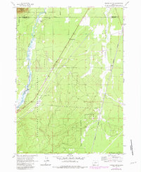
1963 Map of Masten Butte
USGS Topo · Published 1981About this map
Little Deschutes River winds through the western edge of this landscape, its serpentine path cutting through the timberlands of the Deschutes National Forest. The map captures a moment of mid-century infrastructure and land use, defined by the long north-south corridor of the Burlington Northern railroad and an extensive Pipeline that bisects the central forest sections. Settlement is sparse, focused on small hubs like Beal and the Wagon Trail Ranch near the riverbanks.
Find a feature on this map
13 named features on this map. Tap any name to fly to it.
Don’t see what you’re looking for? This feature index may not catch every label — zoom into the map to look around manually.
Map Details
Editions of this 1963 Masten Butte Map
2 editions found

Other maps of this area

1930 · Maiden Peak
USGS Topo · 1:125,000

1931 · Newberry Crater
USGS Topo · 1:125,000

1934 · Maiden Peak
USGS Topo · 1:125,000

1935 · Chemult
USGS Topo · 1:96,000

1935 · Newberry Crater
USGS Topo · 1:125,000

1941 · Chemult
USGS Topo · 1:125,000

1955 · Crescent
USGS Topo · 1:250,000

1957 · Crescent
USGS Topo · 1:250,000

1958 · Crescent
USGS Topo · 1:250,000

1963 · La Pine
USGS Topo · 1:24,000