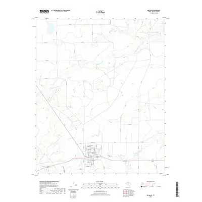
2019 Map of Matador
USGS Topo · Published 2019About this map
Matador serves as the focal point of this West Texas landscape, where the town grid is clearly defined by residential streets such as Houston Ave, Dundee Ave, and Lariat Ave. Located just east of the main settlement is the East Mound Cem, a significant site for genealogical research in Motley County. The surrounding terrain is heavily influenced by the drainage patterns of the Middle Pease River to the north and several smaller watercourses including Longs Br and Ballard Cr. The map captures a high level of detail for local infrastructure, from established state roads like FM 94 to a dense network of named county roads that facilitate movement across the rolling plains. Small bodies of water like Ed Jameson Lake provide further orientation in this agricultural and ranching region.
Find a feature on this map
49 named features on this map. Tap any name to fly to it.
Don’t see what you’re looking for? This feature index may not catch every label — zoom into the map to look around manually.
Map Details
Editions of this 2019 Matador Map
This is the sole edition of this map. No revisions or reprints were ever made.
Other maps of this area

1954 · Lubbock
USGS Topo · 1:250,000

1954 · Plainview
USGS Topo · 1:250,000

1958 · Plainview
USGS Topo · 1:250,000

1966 · Matador
USGS Topo · 1:24,000

1966 · Ballard Camp
USGS Topo · 1:24,000

1967 · Hornica Creek
USGS Topo · 1:24,000

1967 · Turtle Hole Camp
USGS Topo · 1:24,000

1967 · Flomot
USGS Topo · 1:24,000

1967 · Whiteflat
USGS Topo · 1:24,000

1968 · Mac Bain
USGS Topo · 1:24,000