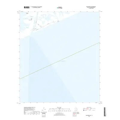
2019 Map of Matagorda SW
USGS Topo · Published 2019About this map
The Colorado River meets the Gulf of Mexico along this stretch of the Texas coastline, where the dynamic barrier island environment is defined by shifting sands and intricate waterways. Navigation through Matagorda Bay is supported by the Tiger Island Channel, which bypasses the natural obstructions of Dog Island Reef and various low-lying landforms like Tiger Island and Greek Island. On the mainland side, Zipperian Bayou winds through the coastal wetlands, reflecting the complex hydrography of Matagorda County. This 2019 survey documents the modern road network serving the beachfront, including Market St, Dunes Dr, and Beach Front Rd, illustrating the intersection of residential development and the natural movement of the Gulf's shoreline.
Find a feature on this map
14 named features on this map. Tap any name to fly to it.
Don’t see what you’re looking for? This feature index may not catch every label — zoom into the map to look around manually.
Map Details
Editions of this 2019 Matagorda SW Map
This is the sole edition of this map. No revisions or reprints were ever made.
Other maps of this area

1951 · Bay City
USGS Topo · 1:250,000

1952 · Palacios SE
USGS Topo · 1:24,000

1952 · Matagorda
USGS Topo · 1:24,000

1952 · Dressing Point
USGS Topo · 1:24,000
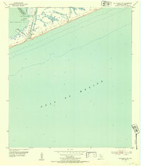
1952 · Matagorda SW
USGS Topo · 1:24,000

1952 · Palacios NE
USGS Topo · 1:24,000

1953 · Beeville
USGS Topo · 1:250,000

1956 · Beeville
USGS Topo · 1:250,000

1956 · Bay City
USGS Topo · 1:250,000

1958 · Bay City
USGS Topo · 1:250,000