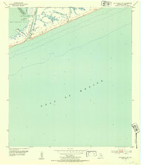
1952 Map of Matagorda SW
USGS Topo · Published 1953About this map
The Matagorda Peninsula forms a narrow barrier between the open waters of the Gulf of Mexico and the protected reaches of Matagorda Bay in this mid-century coastal survey. This maritime landscape is defined by the entrance of the Colorado River, where a Gaging Station and Light mark the vital navigation channel. The intricate marshland and tidal environment are detailed through features like Spring Bayou and Zipprian Bayou, which snake through the peninsula's inner shore. To the west, the bay opens up with named landforms such as Tiger Island and Greek Island, while the Dog Island Reef and Tiger Island Channel provide insight into the underwater topography and historical shipping lanes essential to the Texas Gulf Coast economy during the early 1950s.
Find a feature on this map
12 named features on this map. Tap any name to fly to it.
Don’t see what you’re looking for? This feature index may not catch every label — zoom into the map to look around manually.
Map Details
Editions of this 1952 Matagorda SW Map
2 editions found
Other maps of this area

1951 · Bay City
USGS Topo · 1:250,000

1952 · Palacios SE
USGS Topo · 1:24,000

1952 · Matagorda
USGS Topo · 1:24,000

1952 · Dressing Point
USGS Topo · 1:24,000

1952 · Palacios NE
USGS Topo · 1:24,000

1953 · Beeville
USGS Topo · 1:250,000

1956 · Beeville
USGS Topo · 1:250,000

1956 · Bay City
USGS Topo · 1:250,000

1958 · Bay City
USGS Topo · 1:250,000

1960 · Beeville
USGS Topo · 1:250,000