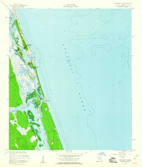
1956 Map of Matanzas Inlet
USGS Topo · Published 1960About this map
Fort Matanzas National Monument guards the southern approach to St. Augustine, anchored by the stone fortification at Ft Matanzas on Rattlesnake Island. This mid-century survey captures the coastal geography of the Matanzas Inlet and the Matanzas River before heavy modern development, showing the isolated seaside character of Summer Haven and the early footprint of Marineland along highway a1a. The map meticulously tracks the Intracoastal Waterway as it snakes behind Anastasia Island and Matanzas Island, cutting through marshlands where Artesian Wells and drainage features like Pellicer Creek meet the tidal flats. The boundary between St. Johns and Flagler counties is clearly delineated across the wetlands near Hemming Point, illustrating the transition from open Atlantic coast to complex estuarine environments.
Find a feature on this map
24 named features on this map. Tap any name to fly to it.
Don’t see what you’re looking for? This feature index may not catch every label — zoom into the map to look around manually.
Map Details
Editions of this 1956 Matanzas Inlet Map
4 editions found
Other maps of this area

1927 · Matanzas
USGS Topo · 1:48,000

1937 · Crescent Beach
USGS Topo · 1:24,000

1937 · Dinner Island
USGS Topo · 1:48,000

1943 · St. Augustine
USGS Topo · 1:62,500

1943 · Dinner Island
USGS Topo · 1:62,500

1943 · Matanzas
USGS Topo · 1:62,500

1944 · Dinner Island
USGS Topo · 1:62,500

1944 · Matanzas
USGS Topo · 1:62,500

1954 · Daytona Beach
USGS Topo · 1:250,000

1956 · Dinner Island NE
USGS Topo · 1:24,000