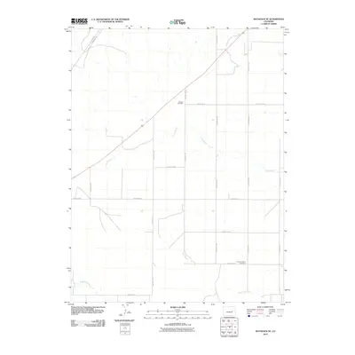
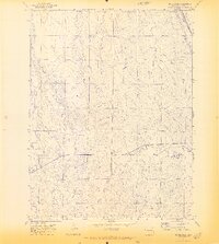
2010 Map of Matheson NE
USGS Topo · Published 2010About this map
Dunkers Cemetery and Pleasant Plains Cemetery serve as the primary historic landmarks in this rural corner of Elbert County. The landscape is defined by its rectilinear grid of section roads and the winding paths of intermittent drainage systems like Long Branch and Long Creek. A notable diagonal route, Resolis Rd County Rd 159, breaks the strict cardinal orientation of the local infrastructure in the northwest, likely following older topographic or transit lines. Toward the southern edge, North Rush Creek meanders through the plains, highlighting the subtle water-dependency of this high prairie environment. This 2010 survey reflects a strictly agricultural and ranching landscape, where name-bearing features are primarily limited to family cemeteries and the essential county road network that connects these isolated homesteads.
Find a feature on this map
19 named features on this map. Tap any name to fly to it.
Don’t see what you’re looking for? This feature index may not catch every label — zoom into the map to look around manually.
Map Details
Editions of this 2010 Matheson NE Map
This is the sole edition of this map. No revisions or reprints were ever made.
Other maps of this area

1891 · Limon
USGS Topo · 1:125,000

1892 · Limon
USGS Topo · 1:125,000

1954 · Limon
USGS Topo · 1:250,000

1957 · Limon
USGS Topo · 1:250,000

1958 · Limon
USGS Topo · 1:250,000
1970 · Matheson SW
USGS Topo · 1:24,000
1970 · Matheson
USGS Topo · 1:24,000
1970 · Matheson SE
USGS Topo · 1:24,000
1970 · Beuck Draw
USGS Topo · 1:24,000

1970 · Limon
USGS Topo · 1:24,000