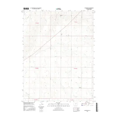
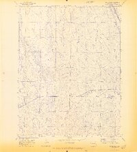
2016 Map of Matheson NE
USGS Topo · Published 2016About this map
Big Sandy Cr and North Rush Cr define the hydrological landscape of this Elbert County region, where the high plains are carved by seasonal drainages. The area is marked by a deliberate grid of county roads, such as Co RD 185 and Co RD 98, which facilitate movement across the sprawling ranchlands. Two significant sites for family historians and genealogists appear on this landscape: Dunkers Cem, located near the center of the survey, and Pleasant Plains Cem further south. These cemeteries, alongside names like Horseshoe Draw, suggest a history of early 20th-century settlement and agricultural endurance in the semi-arid Colorado plains. The map's detail shows how water remains the primary shaper of the terrain, with features like Long Br and Long Cr cutting through the topography in an otherwise highly organized section-and-range land system.
Find a feature on this map
26 named features on this map. Tap any name to fly to it.
Don’t see what you’re looking for? This feature index may not catch every label — zoom into the map to look around manually.
Map Details
Editions of this 2016 Matheson NE Map
This is the sole edition of this map. No revisions or reprints were ever made.
Other maps of this area

1891 · Limon
USGS Topo · 1:125,000

1892 · Limon
USGS Topo · 1:125,000

1954 · Limon
USGS Topo · 1:250,000

1957 · Limon
USGS Topo · 1:250,000

1958 · Limon
USGS Topo · 1:250,000
1970 · Matheson SW
USGS Topo · 1:24,000
1970 · Matheson
USGS Topo · 1:24,000
1970 · Matheson SE
USGS Topo · 1:24,000
1970 · Beuck Draw
USGS Topo · 1:24,000

1970 · Limon
USGS Topo · 1:24,000