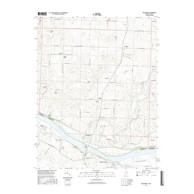
2016 Map of Mauckport
USGS Topo · Published 2016About this map
Mauckport, Indiana, and Brandenburg, Kentucky, sit on opposite banks of the Ohio River, linked by the Matthew Welsh Bridge. This riverfront corridor shows the transition from the rolling elevations of Wolfpen Ridge and Mt Tom down to the fertile Crozier Bottom and the karst topography of the Mitchell Plain. The map documents a rural landscape where small communities like Central, Valley City, and Glidas are connected by a network of local roads such as Harrison Heth Rd SW. Genealogists and local historians can locate family burial sites at Hillgrove Cem and Atwell Cem. The drainage patterns are clearly defined by Lick Run and Buck Creek, which carve through the terrain before joining the Ohio. The intersection of county lines and state boundaries highlights the administrative geography of this Ohio River valley region.
Find a feature on this map
91 named features on this map. Tap any name to fly to it.
Don’t see what you’re looking for? This feature index may not catch every label — zoom into the map to look around manually.
Map Details
Editions of this 2016 Mauckport Map
This is the sole edition of this map. No revisions or reprints were ever made.
Other maps of this area

1928 · Hardinsburg
USGS Topo · 1:48,000

1931 · Hardinsburg
USGS Topo · 1:62,500

1931 · Corydon
USGS Topo · 1:62,500

1941 · Ekron
USGS Topo · 1:62,500

1944 · Corydon West
USGS Topo · 1:24,000

1946 · Rock Haven
USGS Topo · 1:24,000

1946 · Leavenworth
USGS Topo · 1:24,000

1947 · Irvington
USGS Topo · 1:24,000

1947 · Leavenworth
USGS Topo · 1:24,000

1947 · Corydon West
USGS Topo · 1:24,000