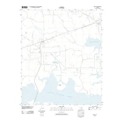
2010 Map of Maud
USGS Topo · Published 2010About this map
Wright Patman Lake dominates the southern reaches of this landscape, its expansive waters and numerous inlets shaping the geography near Maud. The area is defined by a dense network of tributaries including Big Creek, Rock Creek, and Kelley Creek, which flow toward the reservoir. These watercourses created the varied terrain that local families have inhabited for generations, evidenced by the presence of Harris Cemetery and Ridge Cemetery. In the northeast, the settlement of Redwater sits near the crossing of Conn Creek, connected to the surrounding countryside by established routes like Old 67 and Farm Market 3098. The map documents a rural Texas environment where the influence of large-scale water management and traditional small-town centers coexist. Researchers can observe how the shoreline interacts with the local road system at Claiborne Crossing Rd, which leads toward the prominent McFarland Island.
Find a feature on this map
43 named features on this map. Tap any name to fly to it.
Don’t see what you’re looking for? This feature index may not catch every label — zoom into the map to look around manually.
Map Details
Editions of this 2010 Maud Map
This is the sole edition of this map. No revisions or reprints were ever made.
Other maps of this area

1907 · Atlanta
USGS Topo · 1:62,500

1909 · New Boston
USGS Topo · 1:62,500

1909 · Texarkana
USGS Topo · 1:62,500

1910 · Linden
USGS Topo · 1:62,500

1910 · Atlanta
USGS Topo · 1:62,500

1953 · Texarkana
USGS Topo · 1:250,000

1954 · New Boston
USGS Topo · 1:24,000

1954 · Leary
USGS Topo · 1:24,000

1954 · Hooks
USGS Topo · 1:24,000

1954 · Lake Texarkana
USGS Topo · 1:24,000