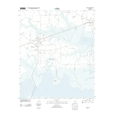
2013 Map of Maud
USGS Topo · Published 2013About this map
The town of Maud serves as the focal point of this northeast Texas landscape, situated at a junction of roads and rail lines just north of the extensive Wright Patman Lake. The map reveals a transition from the established street grids of Maud and Redwater to the sprawling wetlands and open water of the reservoir system. This shoreline is deeply indented by numerous tributaries, including Milan Cr and Kelley Cr, which feed into the lake around landmarks like McFarland Island. Family history and local heritage are anchored by sites such as Harris Cem to the northwest and Ridge Cem near the town center. The presence of several named creeks, like Big Cr and Caney Cr, alongside a network of county roads and logging paths, illustrates a landscape defined by timber, water management, and rural transport routes in the early 21st century.
Find a feature on this map
78 named features on this map. Tap any name to fly to it.
Don’t see what you’re looking for? This feature index may not catch every label — zoom into the map to look around manually.
Map Details
Editions of this 2013 Maud Map
This is the sole edition of this map. No revisions or reprints were ever made.
Other maps of this area

1907 · Atlanta
USGS Topo · 1:62,500

1909 · New Boston
USGS Topo · 1:62,500

1909 · Texarkana
USGS Topo · 1:62,500

1910 · Linden
USGS Topo · 1:62,500

1910 · Atlanta
USGS Topo · 1:62,500

1953 · Texarkana
USGS Topo · 1:250,000

1954 · New Boston
USGS Topo · 1:24,000

1954 · Leary
USGS Topo · 1:24,000

1954 · Hooks
USGS Topo · 1:24,000

1954 · Lake Texarkana
USGS Topo · 1:24,000