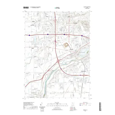
2019 Map of Maumee
USGS Topo · Published 2019About this map
The Maumee River serves as the central artery for this Lucas and Wood County region, defining the boundaries between Perrysburg and Maumee. The landscape is a mix of dense suburban development and significant historical markers, notably Fort Meigs on the river's southern bank. Numerous islands such as Blue Grass Island and Ewing Island punctuate the river's path, while a complex network of drainage ditches like Cairl Ditch and the Grassy Creek Diversion Channel manage the low-lying terrain.
Find a feature on this map
81 named features on this map. Tap any name to fly to it.
Don’t see what you’re looking for? This feature index may not catch every label — zoom into the map to look around manually.
Map Details
Editions of this 2019 Maumee Map
This is the sole edition of this map. No revisions or reprints were ever made.
Other maps of this area

1900 · Toledo
USGS Topo · 1:62,500

1901 · Bowling Green
USGS Topo · 1:62,500

1903 · Bowling Green
USGS Topo · 1:62,500

1909 · Mc Clure
USGS Topo · 1:62,500

1911 · Swanton
USGS Topo · 1:62,500

1914 · Swanton
USGS Topo · 1:62,500

1934 · Rossford
USGS Topo · 1:24,000

1935 · Grand Rapids
USGS Topo · 1:24,000

1935 · Whitehouse
USGS Topo · 1:24,000

1935 · Maumee
USGS Topo · 1:24,000