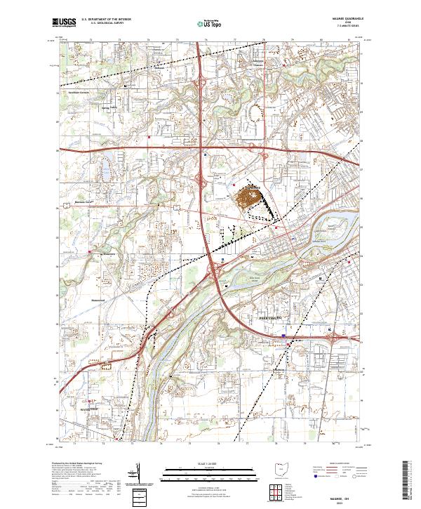
2023 Map of Maumee
USGS Topo · Published 2023About this map
The Maumee River serves as the central artery of this region, separating the settlements of Maumee and Perrysburg just above the notable Maumee Rapids. This area is defined by its deep historical roots, evidenced by the large Maumee Reserve and several significant burial grounds, including Riverside Cem and Fort Meigs Union Cem. The landscape is a complex network of drainage ditches like Nachtrab Ditch and Graham Ditch, which supported the development of the surrounding lowlands.
Find a feature on this map
87 named features on this map. Tap any name to fly to it.
Don’t see what you’re looking for? This feature index may not catch every label — zoom into the map to look around manually.
Map Details
Editions of this 2023 Maumee Map
This is the sole edition of this map. No revisions or reprints were ever made.
Other maps of this area

1900 · Toledo
USGS Topo · 1:62,500

1901 · Bowling Green
USGS Topo · 1:62,500

1903 · Bowling Green
USGS Topo · 1:62,500

1909 · Mc Clure
USGS Topo · 1:62,500

1911 · Swanton
USGS Topo · 1:62,500

1914 · Swanton
USGS Topo · 1:62,500

1934 · Rossford
USGS Topo · 1:24,000

1935 · Grand Rapids
USGS Topo · 1:24,000

1935 · Whitehouse
USGS Topo · 1:24,000

1935 · Maumee
USGS Topo · 1:24,000