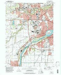
1994 Map of Maumee
USGS Topo · Published 1998About this map
The Maumee River serves as the central artery of this landscape, carving a wide path through the borderlands of Lucas and Wood Counties. At its center, the river surrounds Audubon Island Nature Preserve and Blue Grass Island, marking a significant natural corridor between the expanding urban reach of Toledo and Perrysburg. The map documents a territory defined by its military and colonial heritage, notably preserving the Fallen Timbers State Memorial and Fort Meigs State Memorial, which stand as markers of early American expansion and conflict.
Find a feature on this map
46 named features on this map. Tap any name to fly to it.
Don’t see what you’re looking for? This feature index may not catch every label — zoom into the map to look around manually.
Map Details
Editions of this 1994 Maumee Map
This is the sole edition of this map. No revisions or reprints were ever made.
Other maps of this area

1900 · Toledo
USGS Topo · 1:62,500

1901 · Bowling Green
USGS Topo · 1:62,500

1903 · Bowling Green
USGS Topo · 1:62,500

1909 · Mc Clure
USGS Topo · 1:62,500

1911 · Swanton
USGS Topo · 1:62,500

1914 · Swanton
USGS Topo · 1:62,500

1934 · Rossford
USGS Topo · 1:24,000

1935 · Grand Rapids
USGS Topo · 1:24,000

1935 · Whitehouse
USGS Topo · 1:24,000

1935 · Maumee
USGS Topo · 1:24,000