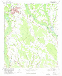
1974 Map of Maxton
USGS Topo · Published 1975About this map
The Seaboard Coast Line railroad cuts a sharp diagonal through this mid-1970s landscape, connecting the town of Maxton with the small community of Alma and the banks of the Lumber River. The river corridor itself is a complex network of wetlands and tributaries, including Gum Swamp and Back Swamp, which dominate the eastern half of the quadrangle. This area preserves a high density of rural religious and educational landmarks, from the Carolina Military Academy in town to outlying congregations like St Pauls Ch, Antioch Mission, and Amos Chapel.
Find a feature on this map
55 named features on this map. Tap any name to fly to it.
Don’t see what you’re looking for? This feature index may not catch every label — zoom into the map to look around manually.
Map Details
Editions of this 1974 Maxton Map
2 editions found
Other maps of this area

1949 · Laurinburg
USGS Topo · 1:24,000

1949 · Wakulla
USGS Topo · 1:24,000

1949 · Laurinburg
USGS Topo · 1:62,500

1953 · Florence
USGS Topo · 1:250,000

1954 · Florence
USGS Topo · 1:250,000

1957 · Laurinburg
USGS Topo · 1:24,000

1971 · Minturn
USGS Topo · 1:24,000

1971 · Johns
USGS Topo · 1:24,000

1972 · Pembroke
USGS Topo · 1:24,000
1972 · Rowland
USGS Topo · 1:24,000