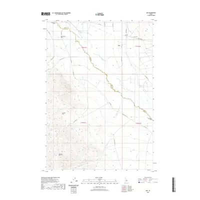
2020 Map of May
USGS Topo · Published 2020About this map
Pahsimeroi Valley serves as the central pastoral corridor of this high-altitude landscape, where the Pahsimeroi River winds between the towering peaks of the Lost River Range and the Pahsimeroi Mountains. The small settlement of May is the primary focal point of human activity, supported by the May Airport and the local May Cem. The land use is defined by a network of drainage creeks such as Sulphur Cr, Lawson Cr, and Morse Cr that feed into the valley from the steep surrounding terrain. Notable geographic features like Burnt Spring Gulch and Blind-Fork Trail Cr highlight the transition from the valley floor to the rugged wilderness. A series of country roads, including Custer Rd and Pahsimeroi Rd, connect the scattered ranching interests along the river, illustrating the region's long-standing agricultural and transport patterns.
Find a feature on this map
36 named features on this map. Tap any name to fly to it.
Don’t see what you’re looking for? This feature index may not catch every label — zoom into the map to look around manually.
Map Details
Editions of this 2020 May Map
This is the sole edition of this map. No revisions or reprints were ever made.
Other maps of this area

1929 · Bayhorse
USGS Topo · 1:125,000

1935 · Borah Peak
USGS Topo · 1:125,000

1938 · Borah Peak
USGS Topo · 1:125,000

1955 · Dubois
USGS Topo · 1:250,000

1956 · Doublespring
USGS Topo · 1:62,500

1956 · May
USGS Topo · 1:62,500

1956 · Challis
USGS Topo · 1:62,500

1957 · Challis
USGS Topo · 1:250,000

1958 · Dubois
USGS Topo · 1:250,000

1960 · Challis
USGS Topo · 1:250,000