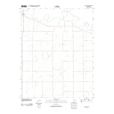
2010 Map of May East
USGS Topo · Published 2010About this map
The settlement of May anchors the northwest corner of this rural survey, where the wide, meandering channel of the Beaver River cuts across the northern reaches of Harper County. The landscape is defined by the heavy braiding and oxbow potential of the river, which is joined by the southward-stretching Sand Creek. Outside the small village center, the area is characterized by a precise grid of rural routes, including n1830 RD and e0300 RD, facilitating transit across the open terrain. Major regional connectors 412 and 270 pass through, highlighting the area's role as a transit corridor in the Oklahoma Panhandle region during the early twenty-first century. This map captures the intersection of water-driven geography and the rigid agricultural section lines that dictate movement and property in the Southern Plains.
Find a feature on this map
21 named features on this map. Tap any name to fly to it.
Don’t see what you’re looking for? This feature index may not catch every label — zoom into the map to look around manually.
Map Details
Editions of this 2010 May East Map
This is the sole edition of this map. No revisions or reprints were ever made.
Other maps of this area

1955 · Woodward
USGS Topo · 1:250,000

1958 · Woodward
USGS Topo · 1:250,000

1969 · Fargo
USGS Topo · 1:24,000

1969 · Fargo NW
USGS Topo · 1:24,000

1969 · Shattuck NE
USGS Topo · 1:24,000

1971 · May East
USGS Topo · 1:24,000

1971 · Fort Supply
USGS Topo · 1:24,000

1971 · Fort Supply NW
USGS Topo · 1:24,000

1971 · Fort Supply NE
USGS Topo · 1:24,000

1971 · Laverne NE
USGS Topo · 1:24,000