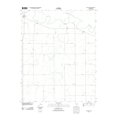
2012 Map of May East
USGS Topo · Published 2012About this map
Beaver River meanders across the northern horizon of this Harper County landscape, defining the hydrology of an area marked by wide plains and seasonal drainages like Sand Cr. The small community of May anchors the northwest corner, where a traditional grid of streets including Broadway and Curtis St meets the open range. Further east, the settlement of Dunlap sits near the riverbanks, illustrating the historical reliance on water sources for early Oklahoma habitation. This 2012 survey by the U.S. Geological Survey documents a sparse settlement pattern dominated by section-line roads and family-linked landmarks. Of particular interest to genealogists is the Mt Olive Cem located in the southeastern quadrant, a vital site for tracing the lineage of those who settled this portion of the High Plains.
Find a feature on this map
24 named features on this map. Tap any name to fly to it.
Don’t see what you’re looking for? This feature index may not catch every label — zoom into the map to look around manually.
Map Details
Editions of this 2012 May East Map
This is the sole edition of this map. No revisions or reprints were ever made.
Other maps of this area

1955 · Woodward
USGS Topo · 1:250,000

1958 · Woodward
USGS Topo · 1:250,000

1969 · Fargo
USGS Topo · 1:24,000

1969 · Fargo NW
USGS Topo · 1:24,000

1969 · Shattuck NE
USGS Topo · 1:24,000

1971 · May East
USGS Topo · 1:24,000

1971 · Fort Supply
USGS Topo · 1:24,000

1971 · Fort Supply NW
USGS Topo · 1:24,000

1971 · Fort Supply NE
USGS Topo · 1:24,000

1971 · Laverne NE
USGS Topo · 1:24,000