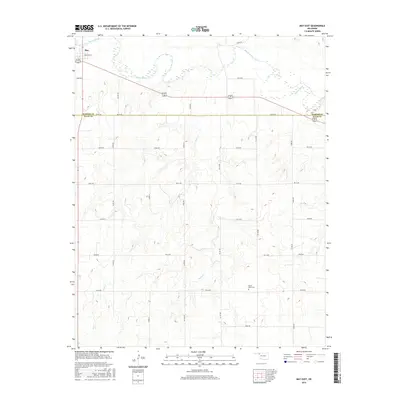
2016 Map of May East
USGS Topo · Published 2016About this map
The settlement of May anchors the northwestern corner of this landscape, situated just south of the Beaver River. This area of Northwest Oklahoma is characterized by the river's winding path and the incision of Sand Cr through the plains. The map captures the dividing line between Harper Co and Ellis Co, a boundary marked by the straight east-west transit of Ew 29 RD. While the northern section is dominated by the river bottomlands, the southern half of the quadrangle rises into more dissected terrain. Local history is anchored at the Mount Olive Cem in the southeastern quadrant, a site serving the surrounding rural homesteads. The road network follows a strict section-line grid, reflecting the late nineteenth-century land survey patterns that defined the region's development.
Find a feature on this map
30 named features on this map. Tap any name to fly to it.
Don’t see what you’re looking for? This feature index may not catch every label — zoom into the map to look around manually.
Map Details
Editions of this 2016 May East Map
This is the sole edition of this map. No revisions or reprints were ever made.
Other maps of this area

1955 · Woodward
USGS Topo · 1:250,000

1958 · Woodward
USGS Topo · 1:250,000

1969 · Fargo
USGS Topo · 1:24,000

1969 · Fargo NW
USGS Topo · 1:24,000

1969 · Shattuck NE
USGS Topo · 1:24,000

1971 · May East
USGS Topo · 1:24,000

1971 · Fort Supply
USGS Topo · 1:24,000

1971 · Fort Supply NW
USGS Topo · 1:24,000

1971 · Fort Supply NE
USGS Topo · 1:24,000

1971 · Laverne NE
USGS Topo · 1:24,000