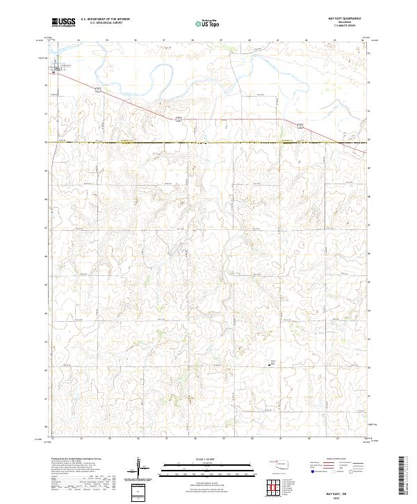
2022 Map of May East
USGS Topo · Published 2022About this map
The settlement of May sits at the northwest corner of this quadrangle, positioned just south of the Beaver River as it winds through the Oklahoma Panhandle transition zone. The landscape is defined by the drainage patterns of Sand Cr, which cuts through the southern reaches of the map, and the rigid grid of county roads that mark the border between Harper and Ellis Counties. This layout illustrates a quintessential High Plains ranching and farming landscape, where habitation is sparse and centered around accessible water sources. Further south, the rural character is underscored by the presence of Mount Olive Cem, a focal point for local history and genealogy located along the section lines between EW 33 Rd and E0340 Rd. The map tracks the precision of the Public Land Survey System, showing several townships including t24n r23w and t25n r24w.
Find a feature on this map
33 named features on this map. Tap any name to fly to it.
Don’t see what you’re looking for? This feature index may not catch every label — zoom into the map to look around manually.
Map Details
Editions of this 2022 May East Map
This is the sole edition of this map. No revisions or reprints were ever made.
Other maps of this area

1955 · Woodward
USGS Topo · 1:250,000

1958 · Woodward
USGS Topo · 1:250,000

1969 · Fargo
USGS Topo · 1:24,000

1969 · Fargo NW
USGS Topo · 1:24,000

1969 · Shattuck NE
USGS Topo · 1:24,000

1971 · May East
USGS Topo · 1:24,000

1971 · Fort Supply
USGS Topo · 1:24,000

1971 · Fort Supply NW
USGS Topo · 1:24,000

1971 · Fort Supply NE
USGS Topo · 1:24,000

1971 · Laverne NE
USGS Topo · 1:24,000