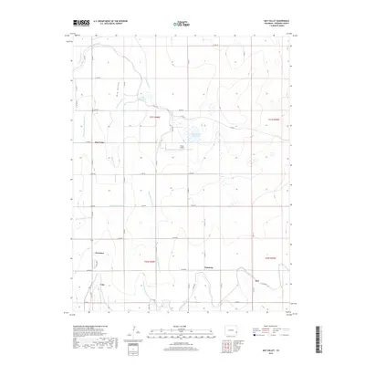
2019 Map of May Valley
USGS Topo · Published 2019About this map
Agricultural water management in Prowers County is clearly delineated in this 2019 survey, where a sophisticated network of canals and laterals dominates the landscape. The Fort Lyon Canal and Amity Canal frame a region defined by the careful movement of water, supporting several small settlements including Kornman, Channing, and Culp. Small water bodies like Prince Reservoir and Fort Lyons Reservoir serve as vital nodes within this grid of irrigation ditches, including the Wheatridge Lateral and Clover Meadow Ditch. Aside from the rural communities, the Tinnes Airport serves as a lone modern landmark within the agricultural blocks. The map provides a detailed view of the section lines and rural road system, such as Co RD RR and Co RD TT, which follow the rigid geometry of the High Plains township and range divisions.
Find a feature on this map
47 named features on this map. Tap any name to fly to it.
Don’t see what you’re looking for? This feature index may not catch every label — zoom into the map to look around manually.
Map Details
Editions of this 2019 May Valley Map
This is the sole edition of this map. No revisions or reprints were ever made.
Other maps of this area

1890 · Granada
USGS Topo · 1:125,000

1892 · Lamar
USGS Topo · 1:125,000

1892 · Granada
USGS Topo · 1:125,000

1894 · Granada
USGS Topo · 1:125,000

1952 · Lamar West
USGS Topo · 1:24,000

1952 · Carlton
USGS Topo · 1:24,000

1953 · Lamar East
USGS Topo · 1:24,000

1954 · Lamar
USGS Topo · 1:250,000

1955 · Granada NW
USGS Topo · 1:24,000

1955 · May Valley
USGS Topo · 1:24,000