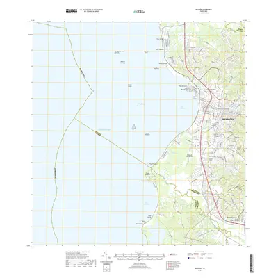
2018 Map of Mayaguez
USGS Topo · Published 2018About this map
MayagüEz and its deep coastal indentation at the Bahía de Mayagüez define this western Puerto Rican landscape. The 2018 survey reveals a dense urban corridor stretching from the Río Yagüez south toward the historic town of Hormigueros. This map is particularly valuable for genealogists, as it identifies several distinct burial grounds including the Cementerio Municipal de Mayagüez and the Cementerio Municipal de Sábalos. Beyond the city, the terrain transitions to the mangrove-lined wetlands of Caño Corazones and the southern Laguna Joyuda. The hydrology is complex, with numerous waterways like Quebrada Grande and Quebrada Pulida draining the hills toward the Caribbean Sea. Offshore, hazardous navigation points such as Roca Blanca and Escollo Rodríguez mark the approach to the harbor, while the northern coast features the sandy reaches of Playa de Mar.
Find a feature on this map
65 named features on this map. Tap any name to fly to it.
Don’t see what you’re looking for? This feature index may not catch every label — zoom into the map to look around manually.
Map Details
Editions of this 2018 Mayaguez Map
This is the sole edition of this map. No revisions or reprints were ever made.
Other maps of this area

1935 · Puerto Real
USGS Topo · 1:25,000

1937 · San German
USGS Topo · 1:25,000

1937 · Puerto Real
USGS Topo · 1:25,000

1938 · Alto Sano
USGS Topo · 1:20,000

1939 · Mayaguez
USGS Topo · 1:30,000

1941 · Rincon
USGS Topo · 1:30,000

1941 · San German
USGS Topo · 1:30,000

1941 · Puerto Real
USGS Topo · 1:30,000

1941 · Rincon
USGS Topo · 1:30,000

1941 · Rosario
USGS Topo · 1:30,000