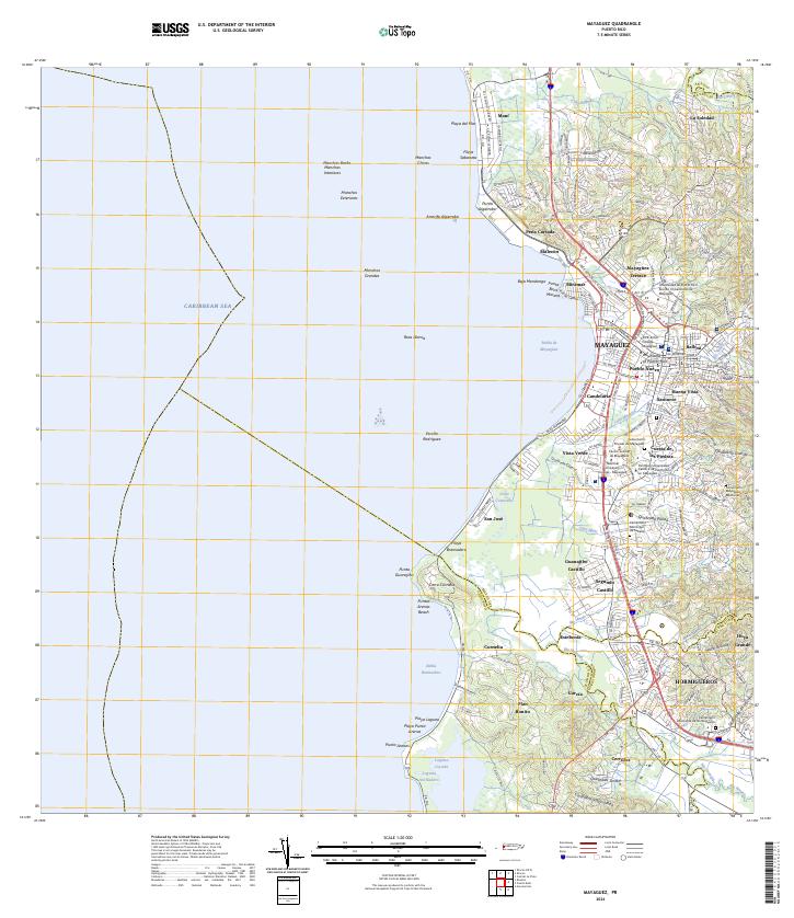
2024 Map of Mayaguez
USGS Topo · Published 2024About this map
The port city of Mayagüez and its coastal surroundings are documented here, showing the dense urban grid of Pueblo Nuevo, Candelaria, and Santurce as they meet the Bahía de Mayagüez. The region's status as an educational and legal hub is evident through landmarks like the Universidad de Puerto Rico Recinto Universitario de Mayagüez and the Centro Judicial de Mayagüez. South of the city, the landscape transitions toward Hormigueros along the fertile valley of the Río Guanajibo, where smaller settlements like Guanajibo Castillo and Segundo Castillo are situated. Along the coastline, the map details complex maritime features including the Arrecife Algarrobo and the extensive Manchas Banks, while the southern reaches reveal the ecologically significant Laguna Joyuda and Laguna Atolladero.
Find a feature on this map
82 named features on this map. Tap any name to fly to it.
Don’t see what you’re looking for? This feature index may not catch every label — zoom into the map to look around manually.
Map Details
Editions of this 2024 Mayaguez Map
This is the sole edition of this map. No revisions or reprints were ever made.
Other maps of this area

1935 · Puerto Real
USGS Topo · 1:25,000

1937 · San German
USGS Topo · 1:25,000

1937 · Puerto Real
USGS Topo · 1:25,000

1938 · Alto Sano
USGS Topo · 1:20,000

1939 · Mayaguez
USGS Topo · 1:30,000

1941 · Rincon
USGS Topo · 1:30,000

1941 · San German
USGS Topo · 1:30,000

1941 · Puerto Real
USGS Topo · 1:30,000

1941 · Rincon
USGS Topo · 1:30,000

1941 · Rosario
USGS Topo · 1:30,000