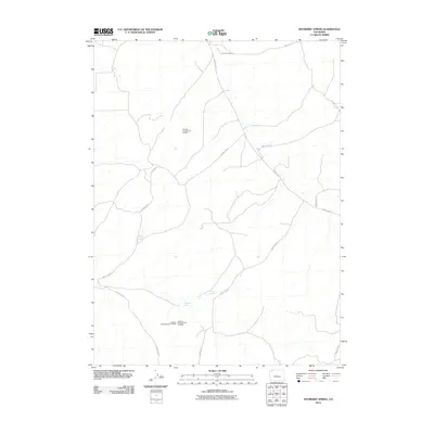
2010 Map of Mayberry Spring
USGS Topo · Published 2010About this map
Mayberry Spring and Clayton Spring offer critical water sources in this high-desert pocket of Moffat County. The landscape is primarily defined by a sparse network of county roads, such as County Hwy-7 and County Rd-131, which connect the isolated rangelands. An intriguing layer of modern industrial survey is visible through the documentation of several mineral exploration sites, including the Airborne Anomaly B17-126 Mine, Airborne Anomaly B17-127 Mine, and Airborne Anomaly B17-128 Mine. These labels suggest a period of targeted aerial geological reconnaissance, likely seeking uranium or other energy-related deposits common to this region of the Colorado Plateau. The lack of traditional town centers highlights the open, unsettled character of this area in the early twenty-first century.
Find a feature on this map
14 named features on this map. Tap any name to fly to it.
Don’t see what you’re looking for? This feature index may not catch every label — zoom into the map to look around manually.
Map Details
Editions of this 2010 Mayberry Spring Map
This is the sole edition of this map. No revisions or reprints were ever made.
Other maps of this area

1916 · Craig
USGS Topo · 1:125,000

1954 · Vernal
USGS Topo · 1:250,000

1954 · Craig
USGS Topo · 1:250,000

1957 · Craig
USGS Topo · 1:250,000

1958 · Vernal
USGS Topo · 1:250,000

1958 · Craig
USGS Topo · 1:250,000

1958 · Maybell
USGS Topo · 1:62,500

1960 · Craig
USGS Topo · 1:250,000

1960 · Vernal
USGS Topo · 1:250,000

1962 · Craig
USGS Topo · 1:250,000