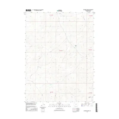
2016 Map of Mayberry Spring
USGS Topo · Published 2016About this map
Mayberry Spring and other vital water sources define the geography of this high-elevation landscape in Moffat County. Located in a region shaped by complex topography, the area features significant drainage patterns like Bighole Gulch and Greasewood Gulch that slice through the terrain. A network of county roads, including Co Rd 7 and Co Rd 50, provides access across the various townships and ranges that divide this open country. The placement of Kelly Spring and Clayton Spring suggests the historical importance of localized water points for land use and navigation in this part of northwestern Colorado. The grid-like survey of the Public Land Survey System overlaying the natural contours reveals how human boundaries were applied to this intricate physical environment.
Find a feature on this map
21 named features on this map. Tap any name to fly to it.
Don’t see what you’re looking for? This feature index may not catch every label — zoom into the map to look around manually.
Map Details
Editions of this 2016 Mayberry Spring Map
This is the sole edition of this map. No revisions or reprints were ever made.
Other maps of this area

1916 · Craig
USGS Topo · 1:125,000

1954 · Vernal
USGS Topo · 1:250,000

1954 · Craig
USGS Topo · 1:250,000

1957 · Craig
USGS Topo · 1:250,000

1958 · Vernal
USGS Topo · 1:250,000

1958 · Craig
USGS Topo · 1:250,000

1958 · Maybell
USGS Topo · 1:62,500

1960 · Craig
USGS Topo · 1:250,000

1960 · Vernal
USGS Topo · 1:250,000

1962 · Craig
USGS Topo · 1:250,000