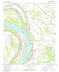
1970 Map of Mayersville
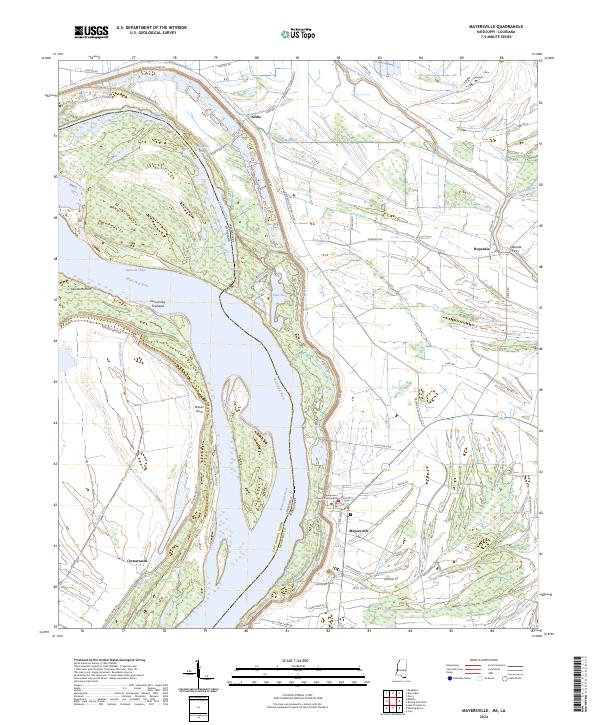
USGS Topo · Published 1986About this map
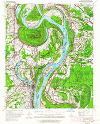
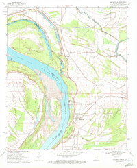
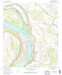
Mayersville serves as the focal point for this Mississippi Delta landscape, situated along the eastern bank of the Mississippi River where the state line meets the East Carroll Parish boundary of Louisiana. The map reveals a complex riverine environment defined by shift-patterns of the water, evidenced by Old River Chute, Opossum Chute, and the prominent Duncansby Towhead. A massive Levee system protects the low-lying agricultural lands to the east, where the community is anchored by local institutions like the New Bethel Ch and the Issaquena Sch. Cultural history is further marked by the presence of Indian Mounds and a solitary Grave near Steele Bayou, while the presence of a Tank Farm and Substation indicates the mid-century industrial utility of this river-bound region.
Find a feature on this map
29 named features on this map. Tap any name to fly to it.
Don’t see what you’re looking for? This feature index may not catch every label — zoom into the map to look around manually.
Map Details
Editions of this 1970 Mayersville Map
3 editions found
Historical Maps of Mayersville Through Time
8 maps found