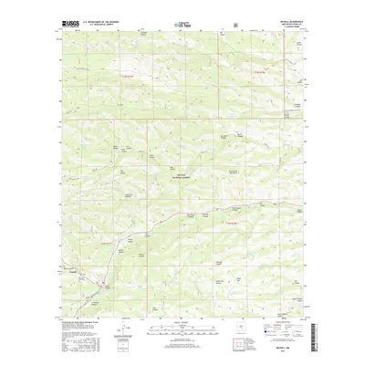
2017 Map of Mayhill
USGS Topo · Published 2017About this map
The mountain community of Mayhill sits at the confluence of several high-elevation drainages within the Lincoln National Forest, serving as a primary settlement point in this portion of the Sacramento Mountains. Life in this high-desert landscape centers on the Rio Peñasco, which snakes through the canyon floor alongside Rio Penasco Rd. The map reveals a high density of water management features essential for ranching and forest service operations, including the Parker Reservoir and numerous livestock tanks like the Big Canyon Tank and Jackson Trick Tank. Local history is anchored by the Mayhill Cem and Mountain Acres Cem, while the rugged geography is defined by deep cuts such as Sixteen Springs Canyon and the evocatively named Graveyard Canyon. These features illustrate a long-standing pattern of settlement and resource management in the Sacramento range.
Find a feature on this map
64 named features on this map. Tap any name to fly to it.
Don’t see what you’re looking for? This feature index may not catch every label — zoom into the map to look around manually.
Map Details
Editions of this 2017 Mayhill Map
This is the sole edition of this map. No revisions or reprints were ever made.
Other maps of this area

1952 · Cloudcroft
USGS Topo · 1:62,500

1954 · Carlsbad
USGS Topo · 1:250,000

1955 · Roswell
USGS Topo · 1:250,000

1958 · Carlsbad
USGS Topo · 1:250,000

1958 · Roswell
USGS Topo · 1:250,000

1962 · Roswell
USGS Topo · 1:250,000

1963 · Clements Ranch
USGS Topo · 1:24,000

1963 · Mayhill
USGS Topo · 1:24,000

1963 · Turkey Peak
USGS Topo · 1:24,000

1963 · Robertson Canyon
USGS Topo · 1:24,000