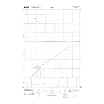
2010 Map of Maynard
USGS Topo · Published 2010About this map
Maynard serves as a focal point for this agrarian landscape in Chippewa County, where the regular grid of township roads meets the diagonal orientation of Spicer Ave. The settlement is anchored by the Maynard Post Office, while the smaller community of Gluek is situated further north along 60th Ave SE. The terrain is defined by the wandering paths of Hawk Creek and Chetomba Creek, which carve natural meanders through the otherwise uniform section lines of the Minnesota prairie. In the southeastern portion of the quadrangle, the Wang Lutheran Church Cemetery provides a significant landmark for genealogical research and local history, marking a site of long-standing community gathering and remembrance near 890th Ave. The map captures the persistent rural structure of the region, where County Highways like County Hwy 10 and County Hwy 55 connect isolated farmsteads to the regional hubs.
Find a feature on this map
30 named features on this map. Tap any name to fly to it.
Don’t see what you’re looking for? This feature index may not catch every label — zoom into the map to look around manually.
Map Details
Editions of this 2010 Maynard Map
This is the sole edition of this map. No revisions or reprints were ever made.
Other maps of this area

1953 · New Ulm
USGS Topo · 1:250,000

1953 · Saint Cloud
USGS Topo · 1:250,000

1957 · Saint Cloud
USGS Topo · 1:250,000

1957 · New Ulm
USGS Topo · 1:250,000

1958 · New Ulm
USGS Topo · 1:250,000

1958 · Saint Cloud
USGS Topo · 1:250,000

1958 · Kerkhoven SE
USGS Topo · 1:24,000

1958 · Kerkhoven SW
USGS Topo · 1:24,000

1958 · Gracelock
USGS Topo · 1:24,000

1965 · Asbury
USGS Topo · 1:24,000