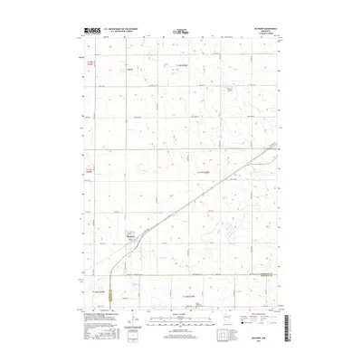
2016 Map of Maynard
USGS Topo · Published 2016About this map
Maynard and the small rail settlement of Gluek anchor this portion of the western Minnesota prairie, where the landscape is defined by the drainage patterns of Hawk Cr and Chetomba Cr. The town of Maynard sits at a geographic junction, situated along Spicer Ave and the diagonal rail line that cuts across the township grids. To the south, the boundary between Chippewa Co and Renville Co is marked by Chip-Renville St SE, highlighting the administrative and survey lines that dictated the region's agricultural development. Local history is preserved at the Wang Lutheran Church Cem near the southern edge, while Howard's Airport serves as a notable landmark in the northern reaches, illustrating the modern aviation footprint atop a traditional farming layout.
Find a feature on this map
30 named features on this map. Tap any name to fly to it.
Don’t see what you’re looking for? This feature index may not catch every label — zoom into the map to look around manually.
Map Details
Editions of this 2016 Maynard Map
This is the sole edition of this map. No revisions or reprints were ever made.
Other maps of this area

1953 · New Ulm
USGS Topo · 1:250,000

1953 · Saint Cloud
USGS Topo · 1:250,000

1957 · Saint Cloud
USGS Topo · 1:250,000

1957 · New Ulm
USGS Topo · 1:250,000

1958 · New Ulm
USGS Topo · 1:250,000

1958 · Saint Cloud
USGS Topo · 1:250,000

1958 · Kerkhoven SE
USGS Topo · 1:24,000

1958 · Kerkhoven SW
USGS Topo · 1:24,000

1958 · Gracelock
USGS Topo · 1:24,000

1965 · Asbury
USGS Topo · 1:24,000