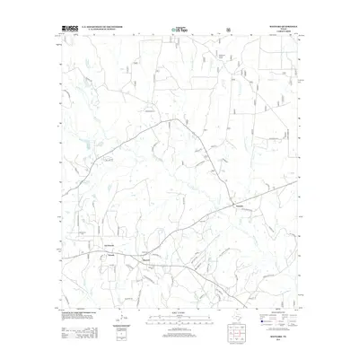
2013 Map of Maynard
USGS Topo · Published 2013About this map
Old Waverly and Maynard sit within a landscape defined by the intricate drainage of Winters Bayou and its numerous tributaries in San Jacinto County. This 2013 survey reveals a pattern of rural Texas settlement where family lineages are preserved in the landscape through sites like Old Waverly Cem, Scott Cem, and Williams Cem. The map illustrates a network of local roads including Old Salem Church Rd and Mcgoffney Rd that connect these smaller hamlets to Pumpkin in the east. Northward, the terrain becomes increasingly defined by watercourses like Chinquapin Cr and W Fork Caney Cr, leading toward the Big Woods Hunter Camp. The transition from the bottomlands of Hardy Bottom to the upland ranching areas at A and W Ranch Lake highlights the enduring agricultural and recreational character of this corner of East Texas.
Find a feature on this map
82 named features on this map. Tap any name to fly to it.
Don’t see what you’re looking for? This feature index may not catch every label — zoom into the map to look around manually.
Map Details
Editions of this 2013 Maynard Map
This is the sole edition of this map. No revisions or reprints were ever made.
Other maps of this area

1954 · Beaumont
USGS Topo · 1:250,000

1957 · Beaumont
USGS Topo · 1:250,000

1958 · Bear Creek
USGS Topo · 1:24,000

1959 · Conroe NE
USGS Topo · 1:24,000

1960 · Willis
USGS Topo · 1:24,000

1960 · Maynard
USGS Topo · 1:24,000

1960 · New Waverly
USGS Topo · 1:24,000

1960 · Stephen Creek
USGS Topo · 1:24,000

1960 · Coldspring
USGS Topo · 1:24,000

1960 · Phelps
USGS Topo · 1:24,000