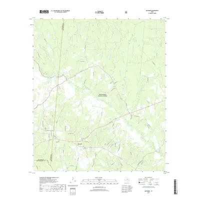
2019 Map of Maynard
USGS Topo · Published 2019About this map
Maynard sits at the intersection of local routes in a heavily wooded landscape defined by the reach of the Sam Houston National Forest. This section of San Jacinto County is marked by an intricate drainage system, with Winters Bayou and its numerous tributaries, including Pumpkin Cr and Chinquapin Cr, winding through the timberland. The map provides significant detail for genealogists and local historians, documenting several small burial sites tucked into the hills, such as Hargrove Cem, Scott Cem, and Williams Cem. The western edge of the quadrangle follows the Walker County and San Jacinto County line, where the terrain transitions toward Old Waverly Cem. The presence of established ranching is noted by features like A and W Ranch Lake, illustrating the rural, agricultural character that persists alongside the protected forest lands.
Find a feature on this map
74 named features on this map. Tap any name to fly to it.
Don’t see what you’re looking for? This feature index may not catch every label — zoom into the map to look around manually.
Map Details
Editions of this 2019 Maynard Map
This is the sole edition of this map. No revisions or reprints were ever made.
Other maps of this area

1954 · Beaumont
USGS Topo · 1:250,000

1957 · Beaumont
USGS Topo · 1:250,000

1958 · Bear Creek
USGS Topo · 1:24,000

1959 · Conroe NE
USGS Topo · 1:24,000

1960 · Willis
USGS Topo · 1:24,000

1960 · Maynard
USGS Topo · 1:24,000

1960 · New Waverly
USGS Topo · 1:24,000

1960 · Stephen Creek
USGS Topo · 1:24,000

1960 · Coldspring
USGS Topo · 1:24,000

1960 · Phelps
USGS Topo · 1:24,000