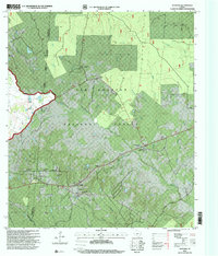
1997 Map of Maynard
USGS Topo · Published 2000About this map
The Sam Houston National Forest dominates this landscape, where the wooded terrain is split by the Walker Co San Jacinto Co boundary. The settlement of Old Waverly serves as a significant historical anchor, featuring the Old Waverly Church and the nearby Old Waverly Cemetery. To the southeast, the community of Maynard is defined by a high concentration of local institutions, including Mount Pilgrim Church, Pine Grove Missionary Church, and the Williams Cemetery.
Find a feature on this map
38 named features on this map. Tap any name to fly to it.
Don’t see what you’re looking for? This feature index may not catch every label — zoom into the map to look around manually.
Map Details
Editions of this 1997 Maynard Map
This is the sole edition of this map. No revisions or reprints were ever made.
Other maps of this area

1954 · Beaumont
USGS Topo · 1:250,000

1957 · Beaumont
USGS Topo · 1:250,000

1958 · Bear Creek
USGS Topo · 1:24,000

1959 · Conroe NE
USGS Topo · 1:24,000

1960 · Willis
USGS Topo · 1:24,000

1960 · Maynard
USGS Topo · 1:24,000

1960 · New Waverly
USGS Topo · 1:24,000

1960 · Stephen Creek
USGS Topo · 1:24,000

1960 · Coldspring
USGS Topo · 1:24,000

1960 · Phelps
USGS Topo · 1:24,000