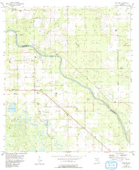
1955 Map of Mayo SE
USGS Topo · Published 1993About this map
The Suwannee River carves a deep, winding path through the borderlands of Suwannee Co and Lafayette Co, serving as the central artery for this mid-century Florida landscape. The terrain is defined by its karst hydrology, featuring numerous notable water sources like Royal Spring, Running Springs, and Convict Spring. These springs, along with Mearson Spring and Owens Spring, reflect the unique limestone geology of the region during the mid-1950s. Rural life is anchored by community landmarks such as Pine Grove Ch, Lady Land Sch, and the Church of God. An Old Railroad corridor and the Grade hint at earlier industrial or logging transport networks that once traversed the area. The small settlement of Midway and various family-named sites like Sears Lake and the Elliott Cem provide specific points of interest for those researching local genealogy or land use patterns in this riverine corridor.
Find a feature on this map
24 named features on this map. Tap any name to fly to it.
Don’t see what you’re looking for? This feature index may not catch every label — zoom into the map to look around manually.
Map Details
Editions of this 1955 Mayo SE Map
4 editions found
Other maps of this area

1954 · Mallory Swamp NW
USGS Topo · 1:24,000

1954 · Dowling Park
USGS Topo · 1:24,000

1954 · Mallory Swamp NE
USGS Topo · 1:24,000

1954 · Gainesville
USGS Topo · 1:250,000

1954 · Valdosta
USGS Topo · 1:250,000

1955 · Mayo NE
USGS Topo · 1:24,000

1955 · Mayo
USGS Topo · 1:24,000

1955 · Mayo SE
USGS Topo · 1:24,000
1956 · Mallory Swamp NW
USGS Topo · 1:25,000

1958 · Valdosta
USGS Topo · 1:250,000