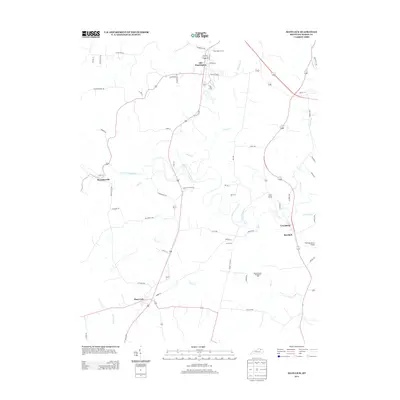
2013 Map of Mays Lick
USGS Topo · Published 2013About this map
Old Washington and Mays Lick anchor this topographic survey of Mason County, showcasing a landscape defined by the winding N Fork Licking River and its numerous tributaries. The map details a predominantly rural agricultural district where historical industry is represented by the Bartholomew-Fitzgerald Mill near Mill Cr. Small settlements like Murphysville, Lewisburg, and Marshall are connected by a network of named pikes and lanes, including Old Sardis Pike and Key Pike, reflecting the traditional Kentucky road patterns that often follow the ridgelines between creek valleys. Local heritage sites are preserved through the locations of Saint Patricks Cem and Finch Cem. The transition from old thoroughfares to modern infrastructure is evident in the Old US 68 Loop and the presence of the Fleming-Mason Airport in the southeastern quadrant.
Find a feature on this map
62 named features on this map. Tap any name to fly to it.
Don’t see what you’re looking for? This feature index may not catch every label — zoom into the map to look around manually.
Map Details
Editions of this 2013 Mays Lick Map
This is the sole edition of this map. No revisions or reprints were ever made.
Other maps of this area

1915 · Maysville
USGS Topo · 1:62,500

1919 · Maysville
USGS Topo · 1:62,500

1929 · Springdale
USGS Topo · 1:48,000

1935 · Springdale
USGS Topo · 1:62,500

1951 · Flemingsburg
USGS Topo · 1:24,000

1952 · Cowan
USGS Topo · 1:24,000

1952 · Maysville East
USGS Topo · 1:24,000

1952 · Germantown
USGS Topo · 1:24,000

1952 · Elizaville
USGS Topo · 1:24,000

1952 · Maysville West
USGS Topo · 1:24,000