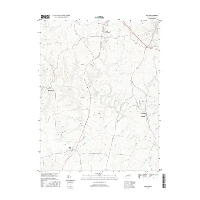
2016 Map of Mays Lick
USGS Topo · Published 2016About this map
Old Washington and Mays Lick anchor this topographic survey of Mason County, Kentucky, where the landscape is defined by the winding course of the North Fork Licking River. The terrain transitions from the upland settlements near Marshall and Lewisburg down into the dense creek networks of Lawrence Cr, Wells Cr, and Lees Cr. For family historians, the map identifies specific burial grounds like Saint Patricks Cem and Finch Cem, alongside small rural hubs such as Murphysville. The road system, including the path of Marshall Station Rd and various local pikes, reflects a community shaped by agricultural tradition, with labels like Tobacco Rd and Ford Acres Farm Rd pointing toward the region's tobacco-growing heritage and river-bottom farming.
Find a feature on this map
50 named features on this map. Tap any name to fly to it.
Don’t see what you’re looking for? This feature index may not catch every label — zoom into the map to look around manually.
Map Details
Editions of this 2016 Mays Lick Map
This is the sole edition of this map. No revisions or reprints were ever made.
Other maps of this area

1915 · Maysville
USGS Topo · 1:62,500

1919 · Maysville
USGS Topo · 1:62,500

1929 · Springdale
USGS Topo · 1:48,000

1935 · Springdale
USGS Topo · 1:62,500

1951 · Flemingsburg
USGS Topo · 1:24,000

1952 · Cowan
USGS Topo · 1:24,000

1952 · Maysville East
USGS Topo · 1:24,000

1952 · Germantown
USGS Topo · 1:24,000

1952 · Elizaville
USGS Topo · 1:24,000

1952 · Maysville West
USGS Topo · 1:24,000