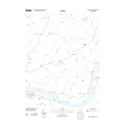
2013 Map of Maysville East
USGS Topo · Published 2013About this map
The Ohio River frontage defines this 2013 survey of the borderlands between Kentucky and Ohio, where the city of Maysville serves as a primary hub for commerce and river transport. Along the southern bank, a series of historic river access points such as The Upper Landing, Coopers Landing, and Roths Landing indicate the long-standing maritime reliance of this region. Moving inland, the landscape is marked by a network of small settlements and family-named landmarks, including Evertonville, Ellsberry, and Bradysville, which are connected by historic routes like Clayton Pike.
Find a feature on this map
119 named features on this map. Tap any name to fly to it.
Don’t see what you’re looking for? This feature index may not catch every label — zoom into the map to look around manually.
Map Details
Editions of this 2013 Maysville East Map
This is the sole edition of this map. No revisions or reprints were ever made.
Other maps of this area

1915 · Maysville
USGS Topo · 1:62,500

1918 · Seaman
USGS Topo · 1:62,500

1919 · Maysville
USGS Topo · 1:62,500

1928 · Higginsport
USGS Topo · 1:48,000

1929 · Springdale
USGS Topo · 1:48,000

1931 · Higginsport
USGS Topo · 1:62,500

1935 · Springdale
USGS Topo · 1:62,500

1952 · Maysville East
USGS Topo · 1:24,000

1952 · Maysville West
USGS Topo · 1:24,000
1952 · Orangeburg
USGS Topo · 1:24,000