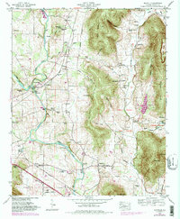
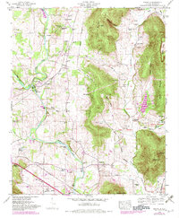
1948 Map of Maysville
USGS Topo · Published 1982About this map
The Flint River meanders through this Madison County landscape, carving a wide valley between Berry Mountain and Nance Mountain. In the late 1940s, this area was defined by a network of small agricultural settlements like Maysville and Burdine, connected by the Louisville and Nashville and Southern railroads. The map documents an older layer of frontier history through the Old Cherokee Boundary line, which bisects the eastern hills near McNutty Reservation. Local industry and community life are anchored at Three Forks by the McCaleb Mill and the Riverton Sch, while numerous family cemeteries such as McCrary Cem and Jordan Cem offer vital clues for genealogical research. The presence of several reservations and the Madison County Lake suggest a transition toward managed land and recreation during the mid-twentieth century.
Find a feature on this map
90 named features on this map. Tap any name to fly to it.
Don’t see what you’re looking for? This feature index may not catch every label — zoom into the map to look around manually.
Map Details
Editions of this 1948 Maysville Map
5 editions found
Other maps of this area

1888 · Scottsboro
USGS Topo · 1:125,000

1888 · Huntsville
USGS Topo · 1:125,000

1892 · Huntsville
USGS Topo · 1:125,000

1892 · Scottsboro
USGS Topo · 1:125,000

1936 · King Cove
USGS Topo · 1:24,000

1936 · Meridianville
USGS Topo · 1:24,000

1936 · Moontown
USGS Topo · 1:24,000

1936 · Fisk
USGS Topo · 1:24,000

1936 · Hollytree
USGS Topo · 1:24,000

1936 · Maysville
USGS Topo · 1:24,000