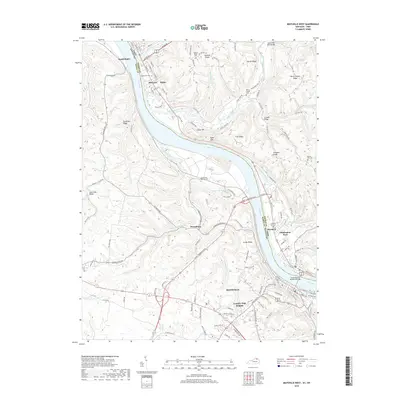
2019 Map of Maysville West
USGS Topo · Published 2019About this map
Maysville and the riverfront communities of Aberdeen and Ripley define this stretch of the Ohio River, where the Kentucky and Ohio border follows the winding water. The landscape is characterized by a series of steep finger ridges such as Puff Ridge, Flaugher Ridge, and Jersey Ridge, which dictate the placement of historic cemeteries and small settlements like Hestoria and Moranburg. At Logan Gap, the terrain creates a natural corridor through the upland heights overlooking the river valley. Genealogists will find a wealth of burial sites including Maplewood Cem and the Charleston Bottom Cem, while the industrial and residential growth of Country Club Heights shows the modern expansion of the Kentucky side. The map detail highlights how the local road network, including Us Rte 68, navigates the complex hydrology of Lawrence Cr and Big Threemile Creek.
Find a feature on this map
130 named features on this map. Tap any name to fly to it.
Don’t see what you’re looking for? This feature index may not catch every label — zoom into the map to look around manually.
Map Details
Editions of this 2019 Maysville West Map
This is the sole edition of this map. No revisions or reprints were ever made.
Other maps of this area

1915 · Maysville
USGS Topo · 1:62,500

1918 · Seaman
USGS Topo · 1:62,500

1919 · Maysville
USGS Topo · 1:62,500

1928 · Higginsport
USGS Topo · 1:48,000

1929 · Springdale
USGS Topo · 1:48,000

1931 · Higginsport
USGS Topo · 1:62,500

1935 · Springdale
USGS Topo · 1:62,500

1952 · Maysville East
USGS Topo · 1:24,000

1952 · Germantown
USGS Topo · 1:24,000

1952 · Higginsport
USGS Topo · 1:24,000