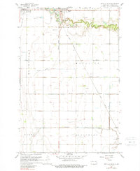
1967 Map of Mayville South
USGS Topo · Published 1989About this map
Portland and Mayville anchor the northern edge of this Red River Valley landscape, where the meandering Goose River breaks the grid of agricultural townships. The town of Mayville is marked by its proximity to Island Park and the municipal Cem, with the Great Northern railway cutting a diagonal path southeast toward the horizon. This period of the mid-1960s shows a region deeply managed by an extensive hydrological network, including the Mayville Drain No 9, Miller Drain No 29, and Blanchard Drain No 23.
Find a feature on this map
21 named features on this map. Tap any name to fly to it.
Don’t see what you’re looking for? This feature index may not catch every label — zoom into the map to look around manually.
Map Details
Editions of this 1967 Mayville South Map
2 editions found
Other maps of this area

1918 · Kelso
USGS Topo · 1:62,500

1943 · Kelso
USGS Topo · 1:62,500

1952 · Grand Forks
USGS Topo · 1:250,000

1956 · Grand Forks
USGS Topo · 1:250,000

1966 · Grand Forks
USGS Topo · 1:250,000

1966 · Galesburg
USGS Topo · 1:24,000

1967 · Mayville South
USGS Topo · 1:24,000

1967 · Blanchard
USGS Topo · 1:24,000
1967 · Hillsboro NW
USGS Topo · 1:24,000
1968 · Galesburg
USGS Topo · 1:24,000