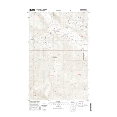
2014 Map of Mazama
USGS Topo · Published 2014About this map
Mazama lies at the junction of the Methow River and Early Winters Cr, serving as a gateway to the high peaks of the Okanogan National Forest. This 2014 survey documents the Methow Valley at a time when the North Cascades Scenic Highway (State Hwy 20) provided the primary artery through this mountainous terrain. The map captures the striking elevation changes between the river valley and prominent landmarks like Goat Wall and Flagg Mtn. Recreational access is highlighted by the Early Winters Campground, while the surrounding landscape is defined by massive peaks including Gardner Mtn and McKinney Mtn. The drainage patterns of Little Boulder Cr and Huckleberry Cr illustrate the complex watershed that feeds the Methow system, showing the geography of the northern Cascades before more recent environmental changes.
Find a feature on this map
30 named features on this map. Tap any name to fly to it.
Don’t see what you’re looking for? This feature index may not catch every label — zoom into the map to look around manually.
Map Details
Editions of this 2014 Mazama Map
This is the sole edition of this map. No revisions or reprints were ever made.
Other maps of this area

1899 · Methow
USGS Topo · 1:125,000

1901 · Methow
USGS Topo · 1:125,000

1902 · Stehekin
USGS Topo · 1:125,000

1904 · Stehekin
USGS Topo · 1:125,000

1920 · Slate Pass
USGS Topo · 1:125,000

1955 · Concrete
USGS Topo · 1:250,000

1958 · Concrete
USGS Topo · 1:250,000

1962 · Concrete
USGS Topo · 1:250,000

1962 · Mazama
USGS Topo · 1:62,500

1963 · Silver Star Mtn.
USGS Topo · 1:24,000