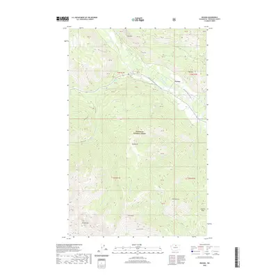
2020 Map of Mazama
USGS Topo · Published 2020About this map
Mazama serves as the primary focal point of this mountain landscape, situated at the confluence of the Methow River and Early Winters Cr. The high-elevation terrain is defined by dramatic peaks such as Gardner Mtn and McKinney Mtn, much of which is contained within the Okanogan National Forest. Notable water features include the remote Varden Lake and the precipitous Cedar Falls on Cedar Creek. The mapping of the Methow Community Trail highlights the recreational value of the valley floor, while numerous tributary streams like Huckleberry Cr and Little Boulder Cr drain the surrounding ridges. Land divisions are clearly marked by several PB tracts, indicating the complex history of land use and surveying in this part of Washington.
Find a feature on this map
49 named features on this map. Tap any name to fly to it.
Don’t see what you’re looking for? This feature index may not catch every label — zoom into the map to look around manually.
Map Details
Editions of this 2020 Mazama Map
This is the sole edition of this map. No revisions or reprints were ever made.
Other maps of this area

1899 · Methow
USGS Topo · 1:125,000

1901 · Methow
USGS Topo · 1:125,000

1902 · Stehekin
USGS Topo · 1:125,000

1904 · Stehekin
USGS Topo · 1:125,000

1920 · Slate Pass
USGS Topo · 1:125,000

1955 · Concrete
USGS Topo · 1:250,000

1958 · Concrete
USGS Topo · 1:250,000

1962 · Concrete
USGS Topo · 1:250,000

1962 · Mazama
USGS Topo · 1:62,500

1963 · Silver Star Mtn.
USGS Topo · 1:24,000