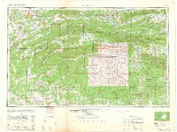
1962 Map of Mc Alester
USGS Topo · Published 1962About this map
McAlester and the high ridges of the Quachita Mountains dominate this 1962 landscape, illustrating a region defined by its timber and coal-mining heritage. The map traces the industrial corridors of the Chicago Rock Island and Pacific RR and the Kansas City Southern RR, which linked the coal-rich settlements of Hartshorne, Wilburton, and Haileyville to broader markets. The topography is characterized by long, parallel ridges such as Winding Stair Mountain and Kiamichi Mountain, much of which is contained within the Quachita National Forest.
Find a feature on this map
236 named features on this map. Tap any name to fly to it.
Don’t see what you’re looking for? This feature index may not catch every label — zoom into the map to look around manually.
Map Details
Editions of this 1962 Mc Alester Map
2 editions found

Other maps of this area

1879 · Poteau Mountain
USGS Topo · 1:62,500

1887 · Poteau Mountain #1
USGS Topo · 1:62,500

1887 · Mount Ida #2
USGS Topo · 1:62,500

1887 · Magazine Mountain #3
USGS Topo · 1:62,500

1887 · Magazine Mountain
USGS Topo · 1:62,500

1887 · Poteau Mountain #2
USGS Topo · 1:62,500

1887 · Greenwood
USGS Topo · 1:62,500

1890 · Magazine Mountain
USGS Topo · 1:125,000

1890 · Mount Ida
USGS Topo · 1:125,000

1890 · Fort Smith
USGS Topo · 1:125,000