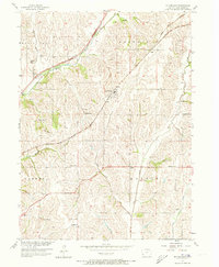
1956 Map of Mc Clelland
USGS Topo · Published 1973About this map
McClelland and Weston serve as the primary rail hubs for this section of Pottawattamie County, positioned along the competing lines of the Chicago Milwaukee St Paul and Pacific and the Chicago Rock Island and Pacific. The landscape is deeply incised by the drainage systems of Mosquito Creek, Keg Creek, and Silver Creek, which dictate the placement of local roads and farmsteads. This mid-century survey captures a rural infrastructure still anchored by a network of local institutions, including Hardin Church, Mt Hope Church, and numbered school districts like School No. 4. Genealogists will find particular value in the clearly marked Downsville Cemetery and Township Cemetery, which remain important landmarks in the townships of Hazel Dell, Norwalk, Garner, and Hardin.
Find a feature on this map
22 named features on this map. Tap any name to fly to it.
Don’t see what you’re looking for? This feature index may not catch every label — zoom into the map to look around manually.
Map Details
Editions of this 1956 Mc Clelland Map
3 editions found
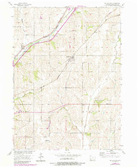
Other maps of this area

1893 · Omaha
USGS Topo · 1:62,500

1954 · Omaha
USGS Topo · 1:250,000

1956 · Underwood
USGS Topo · 1:24,000

1956 · Mineola
USGS Topo · 1:24,000

1956 · Council Bluffs North
USGS Topo · 1:24,000

1956 · Neola
USGS Topo · 1:24,000

1956 · Treynor
USGS Topo · 1:24,000

1956 · Mc Clelland
USGS Topo · 1:24,000

1956 · Council Bluffs South
USGS Topo · 1:24,000

1957 · Omaha
USGS Topo · 1:250,000